 |
 |
 |
Outer Castle Wall of the Tiefburg Castle
Remains of the outer castle walls of the moated castle called Tiefburg (“low castle”). In contrast to the many high castles found on hilltops or hillsides along the route between Heidelberg and Darmstadt, the castle in Handschuhsheim was built on low-lying ground, hence the name „Low Castle“. The castle and its grounds had an overall surface area of around 12 acres, protected by a wall about 15 feet in height.
Other remains of the castle wall can be found in the following streets: Dossenheimer Landstrasse, Mühltalstrasse and Bäumengasse.
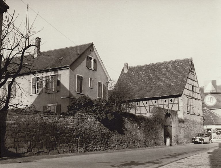
Corner of Kriegsstrasse/Mühltalstrasse (photo: Tiefburg archives)
To the right of this plaque, on the corner of Kriegsstrasse/Mühltalstrasse, stood the last outbuilding of the castle until it was demolished in 1956. Immediately to the right, you can see an arch. No longer visible are the pine cone and alliance arms of Handschuhsheim & Ingelheim (1590) that once crowned the arch.
After the Tiefburg castle had been heavily damaged through several wars in the 17th century, the owners, the Helmstatts, built a new residence in the immediate vicinity in 1700. Incorporated in this new residence was a large wooden gate dating back to 1560, leading from the new residence to the inner castle area. This gate is still visible and is incorporated in the building/restaurant Helmstätter Herrenhaus to the east of the Tiefburg.
The grounds within the outer castle wall were used by the owners as gardens. In the 20th century, several areas were sold off and used as building land for the Tiefburg school, the Protestant Friedenskirche (“Peace Church”) and the Protestant kindergarten. (bm)